Carlson Software is a modular software suite. The individual modules are installed under an existing AutoCAD® or IntelliCAD® installation. An IntelliCAD® installation is included with the purchase of Carlson software modules.
Carlson Software ist a product of Carlson Software Inc.
The modular architecture has a number of advantages for the user:
- Using a standard User Interface, AutoCAD® or IntelliCAD®, allows Carlson to concentrate resources on functionality an realises significant cost savings. This enables users to use a professional software at a highly competitive cost.
- Having a common, single User Interface for all modules significantly enhance ease of use and reduces training requirements.
- All modules interact seamlessly with each other and use the same underlying data sets. This ensures data security and conformity, as there is no need for data exports and imports, data duplication, data re-formatting, etc. Every required data set is only stored in a single version, eliminating the dreaded “version conflicts”.
- Carlson Software covers the entire workflow and value chain of your project: surveying, geological modelling, mine planning, production planning. It even covers a number of reporting options, such as Excel Spreadsheets, PDF, Shape-Files and, of course, DWG and DXF.
A selection of available modules are presented here on this site. Get in touch for more information about Carlson Software, as well as available survey hardware from Carlson.
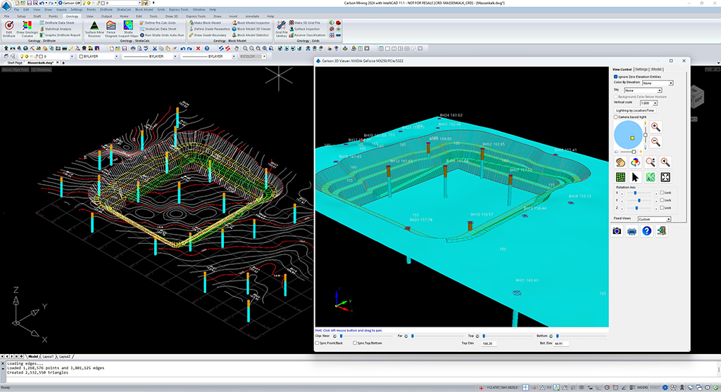
Carlson Geology
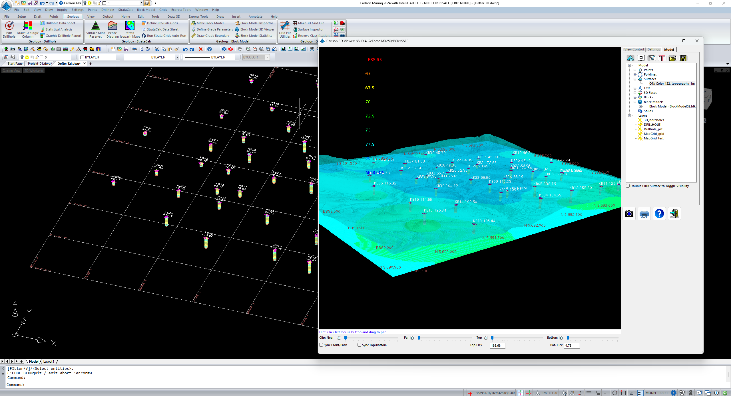
The geology module enables 3D modelling of geological data. Grid and block modelling are available and both methods can be used in combination, which is particularly advantageous for the modelling of layered, thick deposits, such as limestone or potash deposits. In addition to vertical and inclined drillhole data, many other geological data types, such as channel samples and outcrops, can be incorporated. Carlson Geology models physical and chemical parameters and calculates deposit contents for any desired 3D-geometrical shape. Several configurable interpolators, such as Inverse Distance, Voroni, Kriging, among others, are available to ensure that models best reflect the nature of the deposit.
Carlson Surface Mining
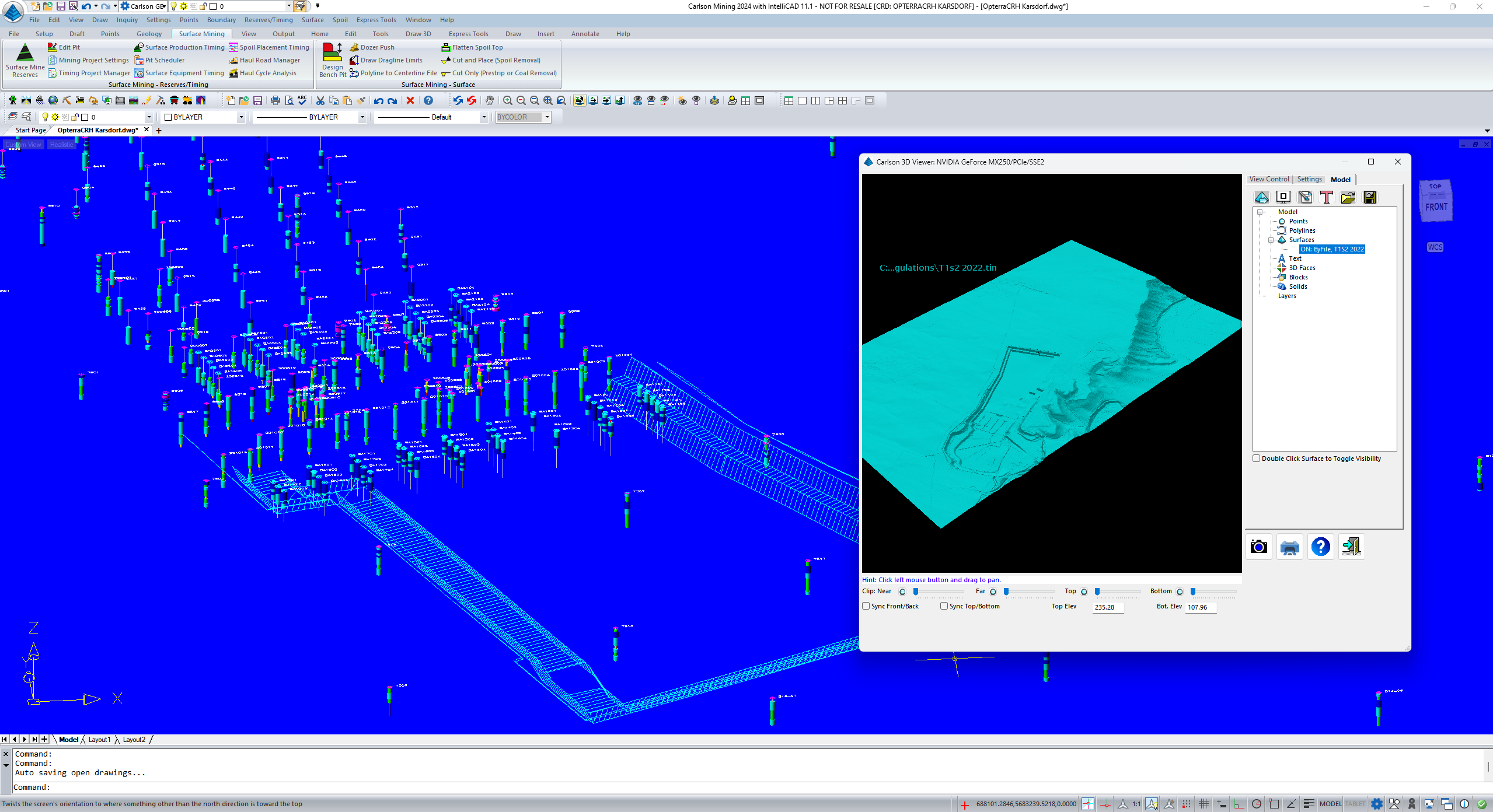
The surface mining module, equally suitable for large mines and small quarries, automates your mine planning. Starting from a terrain model, you can use automated routines for the design of final open pit forms in CAD. Designs are automatically converted to surfaces and volumes calculated. Mining blocks, created manually or automated, allow short- and long-term production planning. The integration of geological models makes it possible to align mining areas with geological conditions. Tonnages and grades per unit of production can be calculated directly, including mining losses, contamination, and dilution. By integrating regular surveys, such as photogrammetry or point clouds, the open-pit mining model can be kept up to date easily.
Carlson Underground
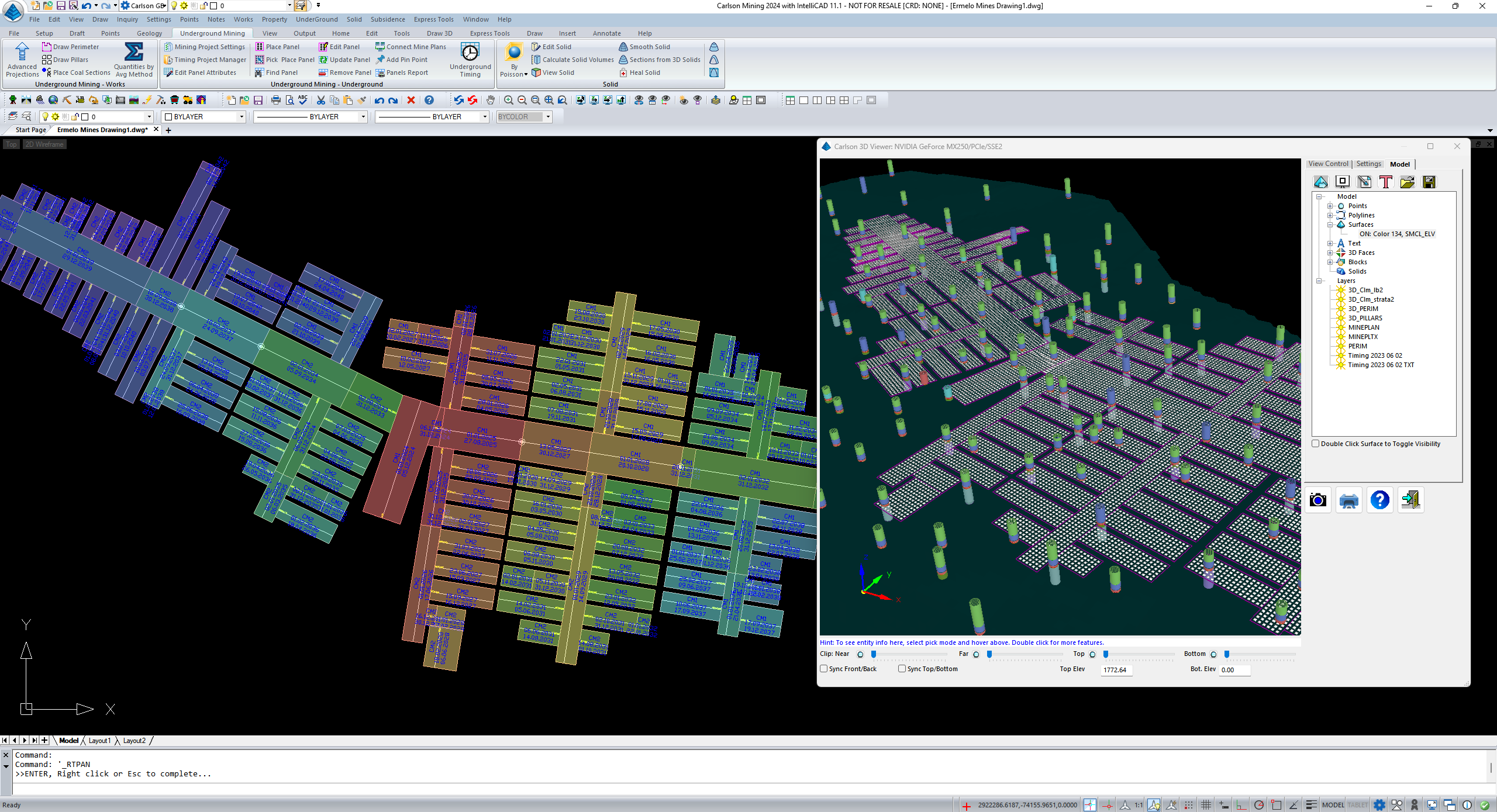
The underground module offers similar functionality to the surface mining module, adapted to underground mining. It offers two functional areas: One area comprises routines for the design and mining planning of tabular reserves with shallow dips, such as potash or coal deposits, by means of room-and-pillar or longwall mining. Another area offers routines adapted for mining massive orebodies or veins. The creation and calculation of production plans is available for all scenarios. Since Carlson is a CAD-based system, the integration of existing mine plans is possible without any problems. It is also possible to convert existing 2D CAD mine plans to a 3D digital twin with Carlson.
Carlson Point Cloud
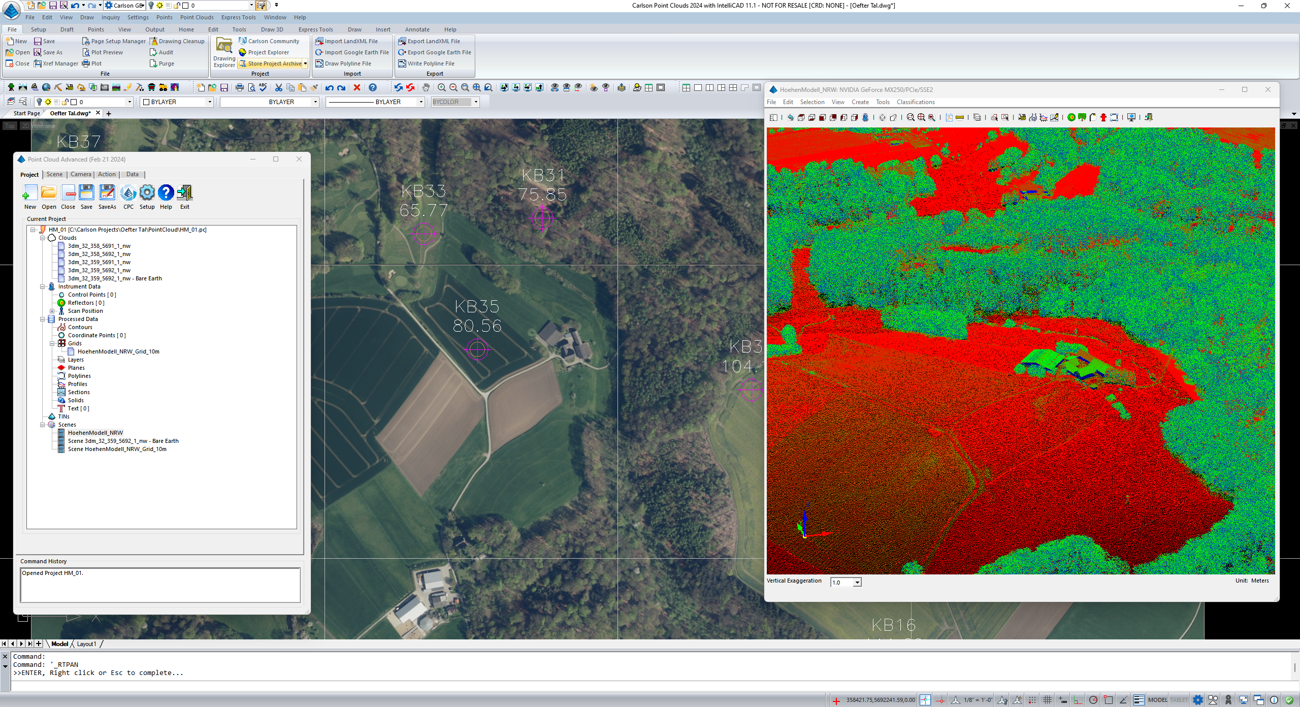
The point cloud module enables the direct integration of point clouds of any kind, such as terrain surveys, buildings, tunnels, surface mines, underground cavities, into existing CAD projects. Point Cloud imports generic or device-specific data. The point clouds can be visually inspected, cleaned and edited. The insertion into the CAD drawing can be as points, as surfaces (grid or triangulation surfaces) or solids, as required. In addition, Point Cloud offers automated routines for editing, such as removing vegetation or buildings.
Carlson Photo Capture
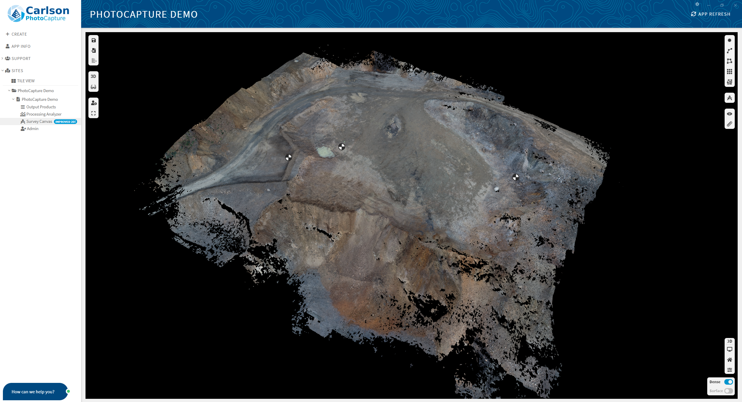
Photo Capture is a standalone photogrammetry software for creating point clouds from photogrammetric surveys. High-precision results are obtained with the help of checkpoints measured and marked in the surveyed area prior to data acquisition. The results can be exported in several formats, as point clouds, as grids or triangulations, as CAD linework, etc. Point clouds from Photo Capture can be transferred directly to other Carlson products, such as Point Cloud, Civil, Geology, etc., allow for a seamless data flow from instrument to CAD.